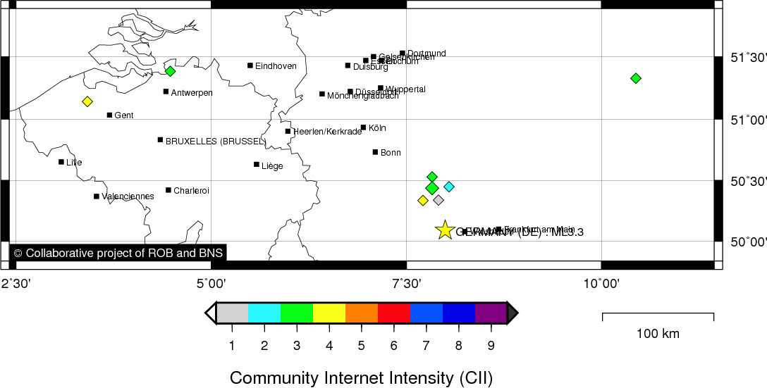
GERMANY (DE) - 2011-02-16 22:09:33
- Magnitude 2.2
Last update : 2023-01-07 15:59:10 Belgian time
Main parameters
| Date and time |
2011-02-16 22:09:33 UTC
2011-02-16 23:09:33 Belgian time |
| Type | Earthquake |
| Magnitude | ML 2.2 |
| Region | GERMANY (DE) |
| Epicentral coordinates | 50.090° N, 8.000° E Uncertainty ± 10.0 km |
| Depth of hypocenter | 10.0 ± 10.0 km |
Data source : ROB (Royal Observatory of Belgium)
Location map
Quake measurements
Measurements by the Belgian seismic network
| Station | Epicentral distance (km) |
P-Wave arrival (hh:mm:ss.ss) | S-Wave arrival (hh:mm:ss.ss) | Maximal ground displacement (nm) |
|
|---|---|---|---|---|---|
| Code | Place | ||||
| MEMS | MEMBACH | 153 | 22:10:08.07 | 22:10:23.42 | 22.5 |
| WLF | WALFERDANGE | 141 | 22:10:08.66 | 22:10:24.18 | 33.6 |
| MEMH1 | MEMBACH | 153 | 22:10:08.78 | - | - |
| EBN | EBEN-EMAEL | 183 | 22:10:11.71 | - | - |
| RCH | ROCHEFORT | 198 | 22:10:16.98 | - | - |
| CLA | CLAVIER | 195 | 22:10:17.40 | - | - |
| DOUH1 | DOURBES | 243 | 22:10:25.87 | - | - |
Macroseismic
Data
| Total number of responses | 9 |
|---|---|
| Intensity I | 1 |
| Intensity II | 1 |
| Intensity III | 5 |
| Intensity IV | 2 |
Attention! The intensities derived from the macroseismic enquiry are raw unverified data.
Map
Data policy
Please read on this notice to learn more about our data policy.